Thursday, June 21
Leaving Manila, we flew to Port Moresby, Papua New Guinea, and then transferred to a flight to Honiara, on Guadalcanal Island, capital of the Solomon Islands. We left Manila at about midnight and arrived in Port Moresby at about 5:00 AM. We then departed Port Moresby at 9:00 AM, arriving in Honiara about noon.
If you count long airport stays (and I do) as "visiting" a country, then Papua New Guinea was my 130th country.
 |
| Proof that I was in New Guinea |
 |
| Local news from Port Moresby |
 |
| Arrival in Honiara |
The Honiara airport is known as
Henderson Field and was started by the Japanese in World War II. When the Americans captured the field, they expanded it and made it their air base for the area. The
Battle of Guadalcanal occurred when the Japanese attempted to retake the island and the Americans successfully defended it. The town of
Honiara pretty much didn't exist before the war.
 |
| Henderson Field |
From the airport we drove to our hotel, the Coral Sea Hotel and Casino, which was on the edge of central Honiara. The hotel, other than some air conditioning issues in my room, was a very nice combination of larger buildings and bungalows. It was right on the water, but there was no beach.
 |
| My room was on the bottom floor, to the left. |
 |
| Some of the hotel bungalows, with hot tubs on the deck |
 |
| In the open air casino |
 |
| My room |
 |
| Hotel pool |
After checking in, we did a tour of Honiara. The Solomon Islands were the poorest country that we visited on the trip. The islands have a population of about 624,000 people, with about 84,000 of them living in Honiara.
 |
| A wreck near the Honiara central market |
Our first stop in Honiara was the central market.
Although Solomon Islanders are dark-skinned (Melanesian), a lot of them have lighter hair. I am told they are the only people in the world who have this combination of traits.
Central Honiara is not very attractive, with relatively few modern or large buildings.
 |
| Most of the commercial enterprises are owned by Chinese |
 |
| A nice, modern building--one of the few in Honiara |
There were an inordinate number of "bottleshops", which sold beer and other beverages.
From the market, we went to the Solomon Islands parliament building. The building was funded by the United States and constructed by the Japanese.
 |
| Solomon Islands Parliament Building |
 |
| Inside the Parliament (picture stolen from the web, since we couldn't take pictures inside) |
 |
| View of Honiara from the Parliament |
We then headed to the
American Guadalcanal Memorial, located on a hill a couple of miles from central Honiara. It was constructed in 1992 and is a very impressive display, documenting all of the events that took place on and around the island during the war.
 |
| View from the memorial of housing on the outskirts of Honiara |
From the memorial, we headed back to the hotel.
 |
| Solomon Island natives--note the hair color |
 |
| View of Parliament from central Honiara |
Friday, June 22
Today was devoted to touring Guadalcanal outside Honiara, mostly sites related to World War II.
The official language of the Solomon Islands is English, but most of the natives speak Pijin, which is a variant of English. A lot of the billboards are in Pijin, but it's pretty easy to make out what they are saying.
 |
| Typical Guadalcanal housing |
Our first stop was the Japanese Guadalcanal memorial.
 |
| Japanese memorial |
Here is some of the foliage at the memorial:
We then drove to a small outdoor museum of war relics near the Betikama school.
Near the school was an impressive open air church.
 |
| A house near the school |
Our next stop was at the airport, where we saw more World War II relics and a memorial forest.
 |
| Anti-aircraft gun at the airport |
 |
| Memorial trees |
 |
| Another blonde Solomon Islander |
 |
| Roadside stands near Honiara |
 |
| Emergency room at the hospital in Honiara |
 |
| Bridge art in Honiara |
 |
| Queen of the Meats |
 |
| And (presumably) her husband |
 |
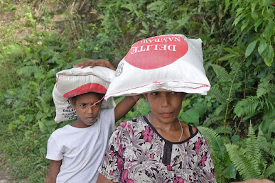
| A truckload of natives we encountered at a gas station |
We then headed to Red Beach, one of the beaches where Americans landed when they invaded Guadalcanal.
 |
| On the beach |
 |
| Some relics and what appeared to be an occupied house |
 |
| I don't know what this was, but presumably what they sold was Kosher |
We then headed to Tetere Beach, a large collection of World War II amphibious vehicles had been abandoned. On the way we passed by coconut plantations and a coconut oil processing plant.
 |
| Coconut plantation |
 |
| Bottle collection at the museum |
There was a local family that lived next to (or maybe on) the museum land and we visited with them.
 |
| The house where the family lived |
Saturday, June 23
Today we made an excursion to Tulagi Island. According to the tour brochure:
Today we will enjoy a full day excursion to Tulagi Island in the Florida Islands group (also known as the Nggela Islands). This island group of the Solomon's sits immediately north of Honiara across the renowned Iron Bottom Sound. This will be a full day of discovery as we cruise through one of the few truly untouched areas of the South Pacific. Our boat trip takes us to Tulagi Island, the old capital of the Solomons.
Tulagi (also known as Tulaghi), was the capital of the Solomon Islands Protectorate from 1896 to 1942, and is today the capital of the Central Province. A visit here is a must visit for the true intrepid traveller, and all of our sightseeing is done on foot. This original capital of the Solomon Islands was severely ravaged during the Second World War, and Honiara became the new capital after the war. Tulagi is in the center and entrance to the Florida Islands. Here one finds small provincial government offices, the police station, post office, main port, market and a few restaurants. Our stop at this colonial capital will include a walking tour, where we experience the true pace of life on an undeveloped island.
 |
| A local ferry (which we didn't take) |
 |
| A view of Honiara from the port |
 |
| I laugh at danger! |
Our first stop on Tulagi was a small hotel/restaurant where we would later have lunch.
As we started walking around the island, I kept seeing what looked like bloodstains on the ground. I began to get concerned about the violence rate, but I eventually figured that they were stains left by people chewing betel nuts. I also began to understand why betel nuts were banned at the airport.
 |
| Not bloodstains |
We pretty much circumnavigated the island on foot. Not any World War II relics, but a good chance to see daily life on the island. I'll let the pictures speak for themselves.
 |
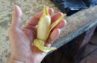
| I don't know what this is, but it's inedible |
Sunday, June 24
Today was devoted to visiting more sites on Guadalcanal.
Below is a billboard we encountered in Honiara. Before you report me to the censors, "pikinini" is a legitimate (to them) Pijin word meaning "student". On the other hand, if you click on the picture to enlarge it, you'll notice a secret code in the lower left corner. Coincidence? I think not....
Our first stop was the
Vilu War Museum, which houses several junked World War II planes, as well as some interesting local flora.
Next we headed for a beach near Honiara, where a Japanese transport had sunk in World War II. We had hoped to go snorkeling there the next day, but as you can see, the weather was a little problematic.
Next, we went to a local village near Honiara.
Near the village was a monument to Sir Jacob Vouza. According to a web site about the monument:
Vouza became a scout for the Americans after he rescued an American Pilot who was shot down. On one of his missions he was captured. After he was tortured extremely to reveal information about the Americans, the Japanese left him in the jungle to die. He chewed through the rope and was able to reach the American camp with important information about the Japanese plans. The American victory in the Battle of Tenaru was said to have been partly the result of his information.
 |
| Sir Jacob Vousa Monument |
Next to the monument was the Rove Prison, which is still awaiting its namesake prisoner.
Finally we returned to the hotel for dinner.
 |
| Serra, our tour leader, telling us where we were |
 |
| Some locals next to the hotel |
Monday, June 25
Our flight to Port Vila, Vanuatu didn't depart until 3:15, so the first part of the day was at leisure. A few of us had planned to go snorkeling at the Japanese wreck (see the picture from yesterday), but they cancelled that, even though the weather didn't seem that bad.
The (nonstop!) flight from Honiara to Port Vila was on Solomons Airlines, but it took place on a plane owned by Nauru Airlines. The entire country of Nauru has about 11,000 people, but they do have a Boeing 737. BTW, as usual, the service on obscure Pacific airlines was much better than on American carriers.
Vanuatu was originally known as the New Hebrides and was colonized at various times by the British and French (sometimes administered jointly) . Vanuatu gained its independence and changed its name in 1980. It has a population of about 270,000, of which 44,000 live in Port Vila.
After (expected) hot at humid weather during the first part of the trip, the weather turned very pleasant in Vanuatu, with the high temperatures in the mid-70's. The cool weather continued in Tonga and Samoa. Granted they are south of the equator, where it was winter, but they are all close enough to the equator that I would have expected it to be hotter.
 |
| The pride of Nauru Airlines |
 |
| Somewhere over Guadalcanal |
Tuesday, June 26
In Port Vila, we stayed at the Holiday Inn Resort (yes,
that Holiday Inn), which was located a couple of miles from the city. Common areas and grounds were really nice, but the rooms needed some maintenance.
 |
| Holiday Inn lobby |
 |
| My room |
The hotel was on a lagoon, and there was a beach, but no ocean views.
First we went to a few sites in
Port Vila, which is the capital of and largest city in Vanuatu.
 |
| National Convention Center |
 |
| Vanuatu Parliament Building |
Eventually, we stopped at the Vanuatu National Museum. In addition to the exhibits, we saw a demonstration of "sand painting", where the artist draws a complex design in the sand without lifting his/her finger. It's more impressive than it sounds.
 |
| Vanuatu National Museum |
 |
| Inside the museum |
 |
| Sand painting demonstration |
 |
| Pottery fragments dating to 1300 BC |
We then drove through Port Vila to our next destination, the Secret Garden. Port Vila, and Vanuatu in general, seemed more prosperous than the Solomon Islands.
 |
| Central Port Vila |
 |
| Pidgin English is in use in Vanuatu |
 |
| Lots of Chinese-owned buisnesses |
 |
| Closest thing to a mall that we saw |
Eventually, we arrived at the Secret Garden, which is a combination of botanical gardens and native cultural center.
 |
| Our greeting at the Secret Garden |
 |
| A shot from the botanical garden |
 |
| Native sand drawing |
 |
| You may remember this group from a previous page |
 |
| Apparently they really were cannibals! |
 |
| About to open a coconut with his bare hand |
 |
| Hangin' with my buds |
 |
| This is a coconut crab. Do not try this at home. |
 |
| A local python |
 |
| Some Vanuatu pidgin |
After the Secret Garden, we headed over to another hotel on a lagoon for lunch. I don't remember what we had, but the setting was excellent.
After lunch, we went to the Cascade Waterfalls. The falls themselves are not that impressive, but it was a nice swimmin' hole (of which I did not partake).
 |
| Cascade Waterfalls |
 |
| Diving action at the falls |
 |
| As close as I got to going in |
From there, we went back to town, visited a local market and had dinner.
 |
| Vanuatu market |
Wednesday, June 27
Today was devoted to seeing other sights on the island, away from Port Vila.
While in Vanuatu, Tonga, and Samoa, we passed a number of Kava bars.
Kava is a drink made from the root of a local plant. According to Wikipedia,
"The root of the plant is used to produce an entheogenic drink with sedative, anesthetic, and euphoriant properties." I tried it a couple of times on the tour and it tastes like dirt. I don't think I drank (or could drink) enough to actually get high on it.
Our first stop was Iarofa Village, another "cultural village" tour. The tour included a demo of underground cooking, mat weaving, and fire walking. Apparently the people actually do live at the village, but I don't think they go around wearing grass skirts after the tourists leave. Also, they made no attempt to cook us.
 |
| The "band" was actually very good |
Next we headed to a local school to meet the students.
 |
| A house near the school |
 |
| School buildings |
 |
| Notice the months of the year in Pidjin |
From the school, we went to Blue Lagoon where I watched other people swim.
 |
| Serra, our tour leader, takes a swing |
After the swim, we dined on some local fruit.
 |
| Passionfruit, I believe |
 |
| I don't know what this is, but apparently it's inedible. Bummer. |
The outside walls on a lot of the houses in Vanuatu are made with woven mats. Most are undecorated, but this one had a bit of style. Also, you may be wondering why there is a German flag on the house below. Vanuatu was going crazy over the World Cup, and since Vanuatu (if they have a team) wasn't playing, everyone in the country seemed to pick a team to root for. There were lots of German, Brazilian, Argentinian, and English flags flying from roofs, trees, and cars all over the country.
Eventually, we arrived at a location on the other side of the island from Port Vila and stopped for lunch.
 |
| Nice view of an outlying island |
 |
| On the beach for lunch |
Lunch was a mixture of local foods, including sweet potatos, cabbage, a plantain-like thing, rice and chicken. We all survived.
 |
| What the locals eat |
 |
| The Local String Band entertained us |
After lunch, we continued to circumnavigate the island.
 |
| A really big Banyan tree |
At about 3:00 we arrived at Havannah Harbour, which is most famous for being where the staff of the TV show
Survivor: Vanuatu stayed. But the main attraction in the area is the Havannah Harbour World War II museum, which as one web site explains:
Ernest has spent his lifetime collecting WWII paraphernalia from the World War II base that was established here within a matter of weeks when he was a child. Ernest can still remember waking up to find his quiet bay full of huge American ships. He proudly shows you his amazing coca cola bottle collection along with the myriad of other WWII bits & pieces, from grenades to razors to fighterplane wreckage to camera cases, he has accumulated over the years.
Ernest gave us an extensive lecture on his experiences and his collection, and I can honestly say that I didn't understand a word he said. But he was entertaining.
From there, we headed back to Port Vila. As we approached the town, we saw the building below. If you saw the movie
My Cousin Vinny, you'll know what the building is.
Thursday, June 28
Today we took a trip to Tanna Island to see the Yassur Volcano, From the tour brochure:
Today we will enjoy a scenic adventure to one of the world's most accessible active
volcanoes! Our Yasur Volcano exploration starts with a scenic one-hour flight to Tanna
Island. This journey takes in the spectacular views of Port Vila Harbour, South Efate and
Erromango with its beautiful coastline (weather-permitting). On the approach to White
Grass Airport in Tanna you will have a great view of the magnificent landscape of Tanna
Island. Here we will be met by our friendly 4WD Safari staff and taken to a local resort for some refreshments. Our Volcano Tour begins with a 4WD journey across the island, passing local villages, dense native bush, stunning views and passing over volcanic ash plains as we approach Yasur Volcano.
Once we reach the summit it is a short 10-minute uphill walk to the rim of the crater, where we will experience the awesome power of the world's most accessible active volcano! This ancient volcano is conspicuously located in one of the most pristine, unspoiled corners of the globe.
The Island of Tanna is a natural paradise and a favorite destination for volcanologists and adventure travellers. In the local native dialect, Yasur means 'Old Man'. This volcano is 361 meters above sea level, and the crater itself is 300 meters wide and 100 meters deep. Visiting Mount Yasur is a 'once in a lifetime' experience, and your opportunity to watch nature at work.
 |
| Map of Vanuatu showing locations of Port Vila and Tanna Island |
 |
| We are the 8:00 flight to Tanna |
 |
| The airport in Port Vila |
 |
| A prop plane, but a big one at least |
 |
| Aerial view of the Port Vila area |
 |
| White Grass airport on Tanna Island |
After landing at White Grass airport, it was a 1 1/2 hour drive over not very good roads to the volcano.
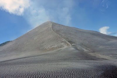
Pictures don't adequately describe what it was like standing next to cone the volcano. Note that there are no guard rails--what could possibly go wrong. The sound, when the volcano wasn't wasn't erupting was like standing behind a jet taking off. Then, about every minute or so, the volcano would erupt, throwing a huge cloud of ash in the air.
 |
| An eruption |
 |
| We don't need no stinkin' guard rail! |
On several occasions, the eruptions through large rocks (boulder-size) into the air, in addition to the ash. Fortunately, we were probably at least a mile from the center, so none of it hit us.
 |
| The black spot in the middle is a big rock being erupted |
Away from the volcano was the usual assortment of local flora.
 |
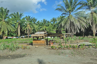
| Palm fruit, from which palm oil is made |
At the end of the afternoon, we boarded our return flight to Port Vila.
That night we had a barbecue dinner at the hotel, complete with a show.
Friday, June 29
Today was a free day, with a late afternoon flight to Tonga, via Fiji. Three of us took the opportunity to go snorkeling at Hideaway Island, near Port Vila.
 |
| Hideaway Island |
 |
| Home of the underwater post office |
First we took a glass-bottomed boat for some fish viewing.
 |
| The boat owner was an Argentina fan |
 |
| View from the size of the boat |
 |
| View from the glass bottom |
The snorkeling was excellent, with lots of fish. Unfortunately, my mask and snorkel (both sets I tried) were defective and I inhaled and swallowed a lot of salt water :-(
After snorkeling, we headed to the airport to catch our flight to Nuku'alofa, Tonga.
 |
| Fuka Oti International Airport in Nuku'alofa, Tonga |
 |
| Our greeting party in the Tonga airport |
Next: Days 16-24 -- Tonga and Samoa


